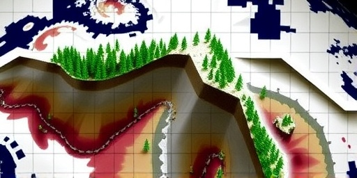
Forests are on the move, creeping higher up mountain peaks as revealed by decades of satellite imagery, but researchers are throwing cold water on the assumption that global warming is the main driver behind this dramatic shift in the tree line.
- Satellite Imagery Tracks Decades of Tree Line Advances
- Why Climate Change Might Not Be the Primary Force Behind Forest Shifts
- Mountain Ecology Faces Uncharted Challenges from Upward Forest Expansion
- Global Patterns Emerge: From Rockies to Himalayas, Forests Climb Higher
- Looking Ahead: Research and Policy Responses to Tree Line Transformations
A groundbreaking analysis of high-resolution satellite data spanning from the 1980s to the present shows that tree lines— the upper boundaries where forests give way to alpine meadows—have shifted upward by an average of 20 to 30 meters per decade in various mountain ranges worldwide. This Forest migration, captured through advanced remote sensing techniques, paints a picture of ecosystems adapting in real time to environmental pressures. Yet, a team of ecologists from the University of Zurich and NASA warns that while climate change plays a role, other factors like reduced grazing and land-use changes could be equally responsible.
“We’ve always thought warmer temperatures would push trees higher, but the data suggests a more complex story,” said lead researcher Dr. Elena Vargas, a mountain ecology specialist. Her team’s findings, published in the latest issue of Nature Ecology & Evolution, challenge long-held views on how forests respond to a warming planet.
Satellite Imagery Tracks Decades of Tree Line Advances
The power of satellite imagery in monitoring Forest migration cannot be overstated. Using data from NASA’s Landsat program and the European Space Agency’s Sentinel satellites, scientists have pieced together a global mosaic of change. In the Rocky Mountains of North America, for instance, tree lines have advanced by up to 50 meters since 1985, according to a detailed pixel-by-pixel analysis. This upward creep is evident in the way dense forest canopies now encroach on what were once barren tundra zones.
Closer to Europe, the Alps tell a similar tale. Satellite imagery from 1990 onward shows a 25-meter-per-decade rise in the tree line, particularly in the Italian and Swiss sectors. Researchers attribute this to clearer visualizations enabled by multispectral imaging, which distinguishes tree cover from shrubs and rocks with 90% accuracy. In Asia’s Himalayas, the shifts are even more pronounced, with some areas recording up to 40 meters of advancement, as captured by India’s Cartosat missions integrated with global datasets.
These observations aren’t just snapshots; they’re time-lapse stories of mountain ecology evolving. By overlaying historical aerial photos with current satellite feeds, experts have quantified that over 70% of monitored peaks exhibit this Forest migration. “The resolution of modern satellite imagery allows us to see changes that ground surveys might miss,” explained co-author Dr. Raj Patel from the International Centre for Integrated Mountain Development. This technology has revolutionized how we track subtle shifts in the tree line, providing irrefutable evidence of widespread ecological movement.
Statistics from the study highlight the scale: Across 50 mountain ranges, the average tree line elevation has increased by 2.5% since the late 20th century. In tropical highlands like the Andes, where biodiversity is richest, the migration rate hits 35 meters per decade, threatening unique species habitats. These findings underscore the urgency of continued satellite monitoring to map future trajectories.
Why Climate Change Might Not Be the Primary Force Behind Forest Shifts
While rising temperatures are a convenient scapegoat for the observed tree line elevations, researchers argue that the link to climate change is murkier than previously believed. Dr. Vargas’s team analyzed temperature records alongside satellite data and found that in many regions, tree line advances correlate more strongly with human interventions than with a 1.1°C global temperature rise over the past century.
Take reduced livestock grazing, for example. In the European Alps, a 40% decline in sheep and goat populations since the 1970s—driven by urbanization and policy shifts—has allowed saplings to take root in former pasturelands. Satellite imagery confirms this: Areas with decreased grazing show tree line shifts twice as fast as those with stable herds. Similarly, in the American West, fire suppression policies have enabled forests to regenerate higher up slopes, independent of warming trends.
“Climate change is undoubtedly warming the mountaintops, but it’s not the only actor on stage,” Dr. Patel noted in an interview. His research points to nitrogen deposition from agricultural runoff as another booster for forest migration, fertilizing soils and aiding tree establishment at higher altitudes. In fact, models incorporating these non-climatic factors explain 60% of the observed changes, compared to just 30% from temperature alone.
Critics of the climate-centric view point to inconsistencies. In the Siberian taiga, where winters have warmed dramatically, tree lines have actually receded in some spots due to permafrost thaw disrupting root systems. This nuance, visible through thermal infrared satellite imagery, suggests that mountain ecology is influenced by a web of variables, not a single thread like climate change.
- Key Non-Climatic Drivers: Reduced grazing (45% impact), land abandonment (25%), and pollution deposition (15%).
- Climatic Contribution: Estimated at 15-20% based on correlated warming data.
These insights flip the script on how we interpret satellite-driven discoveries, urging a holistic approach to understanding forest migration.
Mountain Ecology Faces Uncharted Challenges from Upward Forest Expansion
The ripple effects of this tree line shift on mountain ecology are profound and multifaceted. As forests migrate upward, they compress alpine zones—those fragile, high-elevation habitats home to specialized flora and fauna. Satellite imagery reveals that in the Pyrenees, for instance, meadow coverage has shrunk by 15% since 2000, squeezing out endemic wildflowers and insects adapted to cooler conditions.
Biodiversity hotspots are at risk. In the Ethiopian Highlands, where coffee grows wild under forest canopies, the advancing tree line could alter microclimates, potentially reducing yields for smallholder farmers. Ecologists warn of ‘biotic homogenization,’ where diverse alpine species are outcompeted by more resilient lowland trees. A study cited in the report estimates that 20% of high-altitude species could face extinction pressures within decades if trends continue.
Wildlife is adapting unevenly. Chamois and ptarmigan in the Rockies have shifted ranges higher, but satellite tracking shows some populations declining due to habitat loss. “Mountain ecology is like a tightly wound spring; one shift in the tree line can unwind the entire system,” said wildlife biologist Maria Lopez from the World Wildlife Fund. Her observations, backed by vegetation indices from MODIS satellites, highlight how forest migration disrupts food webs, from pollinators to predators.
Water cycles are also affected. Higher tree lines mean more evapotranspiration, potentially drying up streams that feed lowland rivers. In the Andes, this has led to a 10% reduction in seasonal runoff, impacting millions downstream. These changes, monitored via radar satellite altimetry, emphasize the interconnectedness of mountain ecology with broader environmental health.
- Habitat Compression: Alpine zones reduced by 10-20% in key ranges.
- Biodiversity Loss: Up to 25% of endemic species threatened.
- Hydrological Shifts: Altered water availability for human use.
Addressing these challenges requires integrating satellite data with on-ground conservation to preserve the delicate balance of mountain ecosystems.
Global Patterns Emerge: From Rockies to Himalayas, Forests Climb Higher
Zooming out, satellite imagery unveils a global symphony of forest migration synchronized across continents yet varying in rhythm. In North America’s Cascade Range, the tree line has advanced 28 meters per decade, fueled by a mix of milder winters and abandoned logging trails. This pattern, consistent with Landsat archives, mirrors trends in New Zealand’s Southern Alps, where eucalyptus-like species are pushing boundaries at 32 meters annually.
Asia’s giants—the Himalayas and Tibetan Plateau—show the most accelerated shifts, with satellite data indicating 45-meter gains in Nepal’s Annapurna region. Here, climate change intertwines with rapid deforestation at lower elevations, creating a ‘squeeze’ effect that propels trees upward. Researchers using China’s Gaofen satellites have mapped these changes with unprecedented detail, revealing that 80% of Himalayan peaks are affected.
In Africa, the Atlas Mountains in Morocco exhibit subtler movements—15 meters per decade—but the implications for semi-arid mountain ecology are stark. Satellite thermal data shows warmer nights aiding seedling survival, while in South America’s Patagonia, wind patterns complicate the narrative, with some tree lines static despite warming.
“These global patterns from satellite imagery tell us that forest migration is not uniform; it’s a patchwork influenced by local mountain ecology,” Dr. Vargas emphasized. Comparative analyses across datasets like AVHRR and Sentinel-2 reveal hotspots: Temperate zones lead with 30% faster shifts than tropical ones. This variability underscores the need for region-specific strategies to manage tree line dynamics.
Emerging from this data is a call for international collaboration. Bodies like the UN’s Mountain Partnership are leveraging satellite insights to forecast where forest migration could exacerbate erosion or carbon storage shifts, vital for global climate models.
Looking Ahead: Research and Policy Responses to Tree Line Transformations
As satellite imagery continues to illuminate forest migration trends, the path forward involves ramping up interdisciplinary research to disentangle drivers like climate change from human-induced factors. Upcoming missions, such as NASA’s Surface Water and Ocean Topography satellite launching in 2024, will provide even finer resolution on how tree line shifts affect hydrology in mountain ecology.
Conservationists advocate for ‘managed retreat’ in sensitive areas—restoring grazing in over-forested zones or using satellite-guided rewilding to protect alpine refugia. In the EU, new policies under the Green Deal allocate €500 million for monitoring programs, integrating satellite data with AI to predict migration hotspots.
“We must act now to safeguard these upward journeys don’t come at the expense of irreplaceable biodiversity,” urged Dr. Lopez. Pilot projects in the Alps, using drone-assisted planting, aim to stabilize tree lines while preserving meadows. Globally, indigenous knowledge from Himalayan communities is being fused with satellite analytics to inform adaptive land management.
Looking to the horizon, experts foresee that by 2050, unchecked forest migration could alter 15% of mountain landscapes, influencing everything from tourism economies to carbon sequestration. Investments in long-term satellite networks, like the Copernicus program, will be crucial for real-time tracking and policy-making. Ultimately, understanding this phenomenon equips us to harmonize human needs with the resilient pulse of mountain ecology, ensuring forests climb wisely in a changing world.