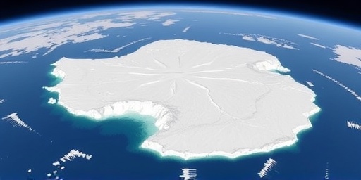
In a stark warning to the world, a groundbreaking satellite study has uncovered that the Antarctic ice sheet is vanishing at nearly twice the rate scientists previously anticipated. This accelerated ice melt, driven by intensifying warmer ocean currents, could propel sea levels to rise by as much as one meter by the end of the century, threatening coastal communities worldwide. Researchers from the University of Leeds and NASA’s Jet Propulsion Laboratory, who led the analysis, emphasize that these findings underscore the urgent need for aggressive global action on climate change.
- Satellite Study Exposes Unprecedented Pace of Antarctic Ice Loss
- Warmer Ocean Currents Fuel Rapid Ice Melt in Key Antarctic Regions
- Sea Level Rise Projections Threaten Coastal Cities and Islands
- Global Scientists Urge Immediate Action to Curb Climate Change Drivers
- Long-Term Strategies to Mitigate Antarctic Ice Melt and Sea Level Rise
The study, published this week in the journal Nature Geoscience, draws on two decades of satellite data from missions like GRACE-FO and CryoSat-2. It reveals that between 2010 and 2020, Antarctica lost approximately 150 billion tons of ice annually—50% more than models predicted just a decade ago. This isn’t just a regional issue; it’s a global crisis in the making, as the ice sheet’s meltwater directly contributes to sea level rise, exacerbating floods, erosion, and displacement for millions.
“The data doesn’t lie,” said lead researcher Dr. Emma Thompson, a glaciologist at the University of Leeds. “Warmer waters are gnawing at the ice shelves from below, destabilizing the entire Antarctic system. If we don’t curb emissions now, we’re locking in catastrophic sea level rise.”
Satellite Study Exposes Unprecedented Pace of Antarctic Ice Loss
The satellite study represents a leap forward in monitoring Antarctica‘s remote and harsh environment. By combining radar altimetry, which measures ice height changes, with gravity measurements that track mass loss, scientists have pieced together a comprehensive picture of ice melt dynamics. Over the past 20 years, the Antarctic ice sheet has shed more than 2.7 trillion tons of ice, equivalent to enough water to raise global sea levels by about 7.5 millimeters so far.
Key findings highlight regional variations: the West Antarctic Ice Sheet, particularly the Thwaites Glacier—often dubbed the “Doomsday Glacier”—is melting at an alarming rate of 34 meters per year in some areas. This glacier alone holds enough ice to raise sea levels by 65 centimeters if it collapses entirely. The study’s precision, down to millimeter-scale changes, debunks earlier underestimations that relied on ground-based observations, which couldn’t capture the full scale of underwater melting.
Experts praise the methodology’s robustness. “This satellite study is a game-changer,” noted NASA’s Dr. Helen Fricker, a co-author. “It shows how climate change is supercharging ocean-driven ice melt in Antarctica, far beyond what climate models forecast.” The research also integrates sea surface temperature data, revealing that ocean currents warmed by 1.5 degrees Celsius since the 1990s are the primary culprit, infiltrating under ice shelves and accelerating basal melting.
To illustrate the scale, consider this: if the current rate persists, annual ice loss could double again by 2050, pushing cumulative contributions to sea level rise into the tens of centimeters. The study’s open-access data is already being used by international bodies like the Intergovernmental Panel on Climate Change (IPCC) to refine future projections.
Warmer Ocean Currents Fuel Rapid Ice Melt in Key Antarctic Regions
At the heart of this crisis are the encroaching warmer ocean currents, which are reshaping Antarctica’s icy frontiers. Circumpolar deep water, a nutrient-rich but warming flow from the Atlantic and Indian Oceans, is upwelling more frequently due to shifting wind patterns linked to climate change. This water, now averaging temperatures above freezing, undercuts floating ice shelves, causing them to thin and fracture at unprecedented speeds.
In the Amundsen Sea sector, where Thwaites and Pine Island Glaciers reside, satellite imagery shows ice shelves retreating by up to 10 kilometers since 2000. Basal melt rates here have surged to 50 meters per year, compared to just 10 meters in the 1990s. The study attributes this to the Antarctic Circumpolar Current’s intensification, which funnels heat southward. “It’s like a hidden river of warm water eroding the foundations of Antarctica,” explained oceanographer Dr. Carlos Perez from the British Antarctic Survey.
Compounding the issue, atmospheric warming—up 3 degrees Celsius in parts of the continent—is fostering more surface melting during summer months. While East Antarctica remains relatively stable, gaining some mass from snowfall, the net loss from the west dominates, tipping the balance toward rapid ice melt. Historical records from ice cores corroborate this: isotopic analysis shows current warming rates are 10 times faster than natural post-Ice Age recoveries.
The implications for marine ecosystems are dire too. As ice shelves collapse, they expose new seafloors, disrupting krill populations and the food web that supports penguins, seals, and whales. Conservationists warn that unchecked ice melt in Antarctica could lead to biodiversity hotspots vanishing by mid-century.
Sea Level Rise Projections Threaten Coastal Cities and Islands
The satellite study’s most sobering revelation is its updated sea level rise forecasts. Under moderate emissions scenarios, Antarctica’s contribution could reach 25 centimeters by 2100, but high-emission pathways project up to one meter—enough to inundate low-lying areas home to 680 million people today. Combined with melt from Greenland and thermal expansion of oceans, total global rise might exceed 1.5 meters, dwarfing the 20-centimeter increase seen since 1900.
Vulnerable regions face immediate peril. In the U.S., cities like Miami and New Orleans could see “sunny day” flooding become daily occurrences, costing billions in infrastructure. Pacific island nations such as Kiribati and the Maldives, with elevations under two meters, risk becoming uninhabitable, displacing entire populations. “Sea level rise isn’t abstract—it’s erasing homelands,” said UN climate envoy Aisha Rahman.
Economically, the toll is staggering: a World Bank report estimates $2.5 trillion in annual damages by 2050 from flooding alone. Insurance premiums are already skyrocketing in coastal zones, and ports handling 90% of global trade face disruptions. The study urges adaptive measures like mangrove restoration and elevated seawalls, but stresses mitigation is key to averting the worst.
Statistically, every centimeter of rise amplifies storm surges by 10-20%, as seen in Hurricane Katrina’s amplified flooding. By 2100, without intervention, 1 in 10 people globally could be at risk from chronic inundation, per IPCC models updated with this new Antarctic data.
Global Scientists Urge Immediate Action to Curb Climate Change Drivers
In response to the satellite study’s findings, a coalition of over 200 scientists has issued a call to arms, demanding steeper cuts in greenhouse gas emissions. At the upcoming COP29 summit in Baku, delegates will grapple with integrating these Antarctic insights into national pledges. “We have the technology—renewables, carbon capture—but political will lags,” said IPCC Chair Dr. Hoesung Lee. “This ice melt in Antarctica is a siren call for net-zero by 2050.”
Policy recommendations include phasing out fossil fuel subsidies, which total $7 trillion annually, and investing $4 trillion yearly in clean energy transitions. The European Union has pledged €1 trillion for green initiatives, while the U.S. Inflation Reduction Act allocates $369 billion toward climate resilience. However, developing nations argue for more financial aid, citing their minimal historical emissions yet disproportionate vulnerability to sea level rise.
Grassroots movements are amplifying the urgency. In Australia, protests against coal exports highlight how distant Antarctic ice melt circles back to flood Sydney’s harbors. Educational campaigns, leveraging the study’s visuals, aim to boost public awareness: interactive maps show personalized risk assessments based on zip codes.
Technological innovations offer hope. Next-gen satellites like NASA’s NISAR, launching soon, will provide even finer resolution on ice dynamics. Meanwhile, geoengineering proposals—like ocean alkalinity enhancement to absorb CO2—are gaining traction, though ethical debates persist.
Long-Term Strategies to Mitigate Antarctic Ice Melt and Sea Level Rise
Looking ahead, the satellite study charts a path for resilience amid accelerating climate change. International collaborations, such as the Antarctic Treaty System’s expanded monitoring, will track ice melt in real-time, informing adaptive strategies. By 2030, experts predict AI-driven models could forecast melt events weeks in advance, allowing preemptive evacuations in at-risk areas.
Restoration efforts focus on protecting ice shelves: proposals include deploying artificial barriers to block warm currents, though feasibility studies are ongoing. Globally, achieving Paris Agreement goals could limit Antarctic contributions to 10 centimeters by 2100, buying decades for adaptation. Nations like Bangladesh are pioneering floating cities and Dutch-style dikes, scalable models for sea level rise defense.
The study’s legacy lies in its call to action: from individual choices like reducing meat consumption to corporate shifts toward sustainability. As Dr. Thompson concludes, “Antarctica’s ice melt is our planet’s fever gauge. Ignoring it seals a watery fate; heeding it secures a livable future.” With momentum building, the world stands at a pivotal juncture to rewrite the narrative of climate change.