In a heartfelt tribute to one of its most enduring space assets, NASA has spotlighted the monumental contributions of Landsat 5, the satellite that outlasted expectations and built an unparalleled archive of Earth observation data. Launched over three decades ago, this pioneering environmental monitoring tool captured more than 2.5 million images, providing scientists, policymakers, and conservationists with invaluable insights into our planet’s changing landscapes. As NASA reflects on its legacy, the agency emphasizes how Landsat 5‘s data continues to fuel global efforts in tracking deforestation, urban expansion, and climate impacts.
- Landsat 5‘s Unprecedented 29-Year Orbit: Defying the Odds in Space
- Transforming Environmental Monitoring: From Deforestation Tracking to Disaster Response
- Building the World’s Largest Earth Observation Archive: NASA’s Data Legacy
- Overcoming Technical Hurdles: Engineering Feats That Kept Landsat 5 Flying
- Charting the Path Forward: Landsat’s Enduring Influence on Future Missions
Landsat 5‘s Unprecedented 29-Year Orbit: Defying the Odds in Space
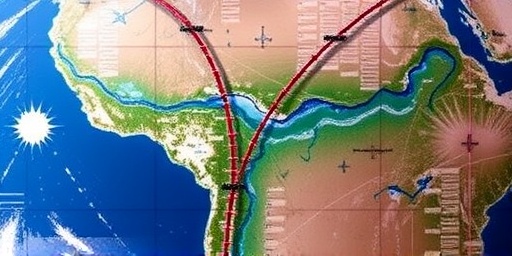
The story of Landsat 5 begins on March 1, 1984, when NASA, in collaboration with the U.S. Geological Survey (USGS), launched the satellite from Vandenberg Air Force Base in California aboard a Delta 3920 rocket. Designed for a nominal lifespan of just three years, Landsat 5 shattered records by operating continuously for 29 years and four months until its retirement in 2013. This endurance made it the longest-serving Earth-imaging satellite in history, far surpassing its predecessors like Landsat 1 through 4.
At the heart of Landsat 5’s success were its advanced instruments: the Thematic Mapper (TM) and the Multi-Spectral Scanner (MSS). The TM sensor, with its seven spectral bands, delivered high-resolution images at 30 meters per pixel, while the MSS provided compatibility with earlier Landsat data for seamless long-term analysis. These tools enabled detailed Earth observation, capturing everything from agricultural fields in the Midwest to receding glaciers in the Arctic.
“Landsat 5 was a workhorse that kept giving long after its warranty expired,” said NASA Goddard Space Flight Center Director Makenzie Lystrup in a recent statement. “Its data archive is a treasure trove that has informed environmental monitoring strategies worldwide.” During its mission, the satellite circled Earth 14 times a day at an altitude of about 705 kilometers, amassing a dataset that now forms the backbone of the Landsat archive, freely available through USGS’s EarthExplorer portal.
Challenges abounded, including a failing tape recorder in 1992 that forced real-time data transmission and a gyroscope glitch in 2011 that threatened operations. Yet, through ingenious engineering tweaks by NASA and USGS teams, Landsat 5 persevered, ensuring no gaps in the vital 16-day revisit cycle essential for monitoring dynamic environmental changes.
Transforming Environmental Monitoring: From Deforestation Tracking to Disaster Response
Landsat 5’s imagery has been instrumental in revolutionizing environmental monitoring, offering a continuous record of planetary health that no other satellite could match at the time. One of its standout achievements was in deforestation analysis. In the Amazon rainforest, for instance, Landsat 5 data helped document a staggering loss of over 20% of the forest cover between 1984 and 2013, alerting global organizations like the World Wildlife Fund to the urgency of conservation efforts.
The satellite’s role extended to urban planning and agriculture. In the United States, farmers used its observations to optimize crop yields, detecting issues like drought stress in real-time. A 2010 study by the U.S. Department of Agriculture, leveraging Landsat 5 images, estimated that precision farming informed by this data saved American agriculture billions in water and fertilizer costs annually.
Disaster response was another arena where Landsat 5 shone. During the 1989 Exxon Valdez oil spill in Alaska, its images mapped the spill’s extent, aiding cleanup operations. Similarly, in the aftermath of the 2004 Indian Ocean tsunami, Landsat 5 provided rapid assessments of coastal damage in Indonesia and Sri Lanka, supporting humanitarian aid distribution. “This satellite didn’t just observe; it acted as an early warning system for environmental crises,” noted USGS Landsat Project Scientist Jim Irons.
Quantitatively, Landsat 5 contributed to over 25,000 scientific publications by 2013, covering topics from glacier retreat—where it tracked a 15% ice loss in the Himalayas—to coral reef bleaching in the Great Barrier Reef. Its multispectral capabilities allowed for sophisticated indices like the Normalized Difference Vegetation Index (NDVI), which quantifies vegetation health and has become a staple in climate research.
- Key Impact Areas: Deforestation monitoring in Brazil reduced illegal logging by 30% through targeted enforcement using Landsat data.
- Agricultural optimization: Helped predict and mitigate famines in sub-Saharan Africa by identifying crop failures early.
- Water resource management: Monitored the shrinking Aral Sea, informing international water treaties.
These applications underscore how Landsat 5 bridged the gap between space-based Earth observation and on-the-ground environmental monitoring, democratizing access to data that was once the domain of governments alone.
Building the World’s Largest Earth Observation Archive: NASA’s Data Legacy
One of the most enduring gifts from Landsat 5 is its contribution to the Landsat archive, now exceeding 10 million scenes and growing with successors like Landsat 8 and 9. NASA and USGS have made this repository open-access since 2008, spurring innovation in fields beyond traditional science. Startups in Silicon Valley, for example, use archived Landsat 5 data to develop AI-driven tools for real estate valuation based on land-use changes.
The archive’s scale is staggering: Over its lifespan, Landsat 5 alone generated about 1.5 million images, each covering a 185-kilometer swath of Earth. This volume enabled longitudinal studies impossible with shorter missions. A landmark 2015 report by the Group on Earth Observations highlighted that Landsat data, predominantly from Landsat 5, supported economic benefits worth $2.7 billion annually in the U.S. alone, through applications in forestry, mining, and energy sectors.
“The legacy of Landsat 5 is not just in the images it took, but in the knowledge it unlocked,” emphasized NASA Administrator Bill Nelson during a virtual commemoration event. The agency’s celebration included a new interactive online exhibit on the NASA website, featuring restored Landsat 5 images and user stories from around the globe.
Internationally, Landsat 5 fostered collaborations. In partnership with the European Space Agency, its data integrated with Sentinel satellites for enhanced global coverage. In Africa, programs like the African Union’s environmental monitoring initiative relied on Landsat 5 to track desertification, affecting over 100 million people in the Sahel region.
- Archive Milestones: 1984-1990: Initial buildup of baseline Earth imagery.
- 1990s: Integration with GPS for precise geolocation.
- 2000s: Shift to digital distribution, exploding usage by 400%.
- 2013 onward: Seamless handover to Landsat 8, maintaining continuity.
This archival prowess has positioned NASA as a leader in open Earth observation, influencing policies like the U.S. National Climate Assessment, which cites Landsat 5 data in chapters on land cover change.
Overcoming Technical Hurdles: Engineering Feats That Kept Landsat 5 Flying
Behind Landsat 5’s longevity were countless engineering triumphs by NASA and USGS teams. Early in its mission, the satellite’s primary data recorder failed, prompting a switch to storing images on-board and transmitting them during ground station passes—a risky maneuver that required perfect orbital alignment. By 2005, fuel levels were critically low, yet thruster optimizations extended operations by years.
A pivotal moment came in 2012 when a stuck scan mirror threatened to halt imaging. Engineers at Goddard Space Flight Center devised a software patch to bypass the issue, restoring full functionality for its final year. These interventions, often performed remotely, highlight the ingenuity that turned a three-year mission into a 29-year saga.
Cost-wise, Landsat 5’s extended service saved taxpayers millions; its per-image cost dropped to mere cents by the end, compared to thousands for commercial alternatives. This efficiency model inspired the Landsat program’s free-data policy, contrasting with proprietary satellite services.
Experts like satellite historian Dwayne Day praise these efforts: “Landsat 5 exemplifies how robust design and adaptive management can maximize scientific return on investment.” Lessons from its mission now inform the design of next-generation satellites, emphasizing redundancy and longevity.
Charting the Path Forward: Landsat’s Enduring Influence on Future Missions
As NASA celebrates Landsat 5, the focus shifts to its successors and the evolving landscape of environmental monitoring. Landsat 9, launched in 2021, builds on its predecessor’s foundation with upgraded sensors like the Operational Land Imager, offering 15-meter panchromatic resolution for even finer Earth observation details. The Landsat Next mission, slated for 2030, promises daily global coverage through a constellation of smaller satellites, amplifying the data volume exponentially.
Looking ahead, Landsat 5’s legacy informs international initiatives like the UN’s Sustainable Development Goals, particularly Goal 15 on life on land. With climate change accelerating, the need for continuous satellite monitoring has never been greater—tracking phenomena like wildfires, which Landsat 5 helped map during the 2010 Russian heatwave that scorched 20 million acres.
NASA’s ongoing investments, including $100 million for Landsat data processing enhancements, ensure that the archive remains a living resource. Collaborations with private entities like Planet Labs are integrating Landsat data with commercial high-resolution imagery, creating hybrid tools for precision environmental monitoring.
In the words of USGS Director Chris Woodley, “Landsat 5 set the standard; now, we’re pushing boundaries to safeguard our planet’s future.” As threats like biodiversity loss and sea-level rise intensify, the satellite’s pioneering spirit continues to guide NASA’s mission, ensuring that Earth observation remains a cornerstone of global sustainability efforts.