In a groundbreaking revelation from satellite monitoring, Forests worldwide are pushing their boundaries higher up mountain peaks, with tree lines advancing at rates that defy simple explanations tied to global warming. This unexpected migration, captured through decades of satellite imagery, suggests that factors beyond climate change—such as land-use changes and invasive species—may be the primary drivers, upending long-standing scientific models of ecosystem adaptation.
- Satellite Imagery Exposes Rapid Tree Line Advances Across Continents
- Unpacking Alternative Forces: Land Use and Human Impacts on Tree Lines
- Challenging Climate Change Paradigms in Mountain Ecosystems
- Expert Insights and Global Reactions to the Tree Line Revelation
- Future Trajectories: Balancing Forest Gains with Ecological Risks
Satellite Imagery Exposes Rapid Tree Line Advances Across Continents
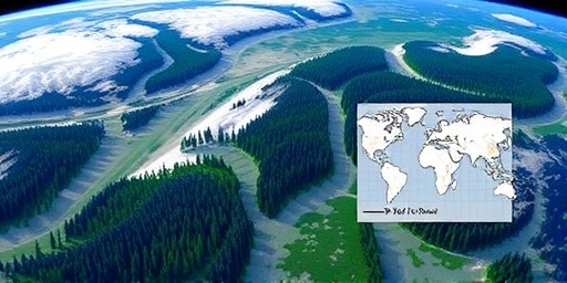
High-resolution satellite imagery analyzed by a team of ecologists from the University of Colorado has documented tree lines creeping upward on mountain peaks in regions as diverse as the Alps, the Rockies, and the Andes. Over the past 30 years, these boundaries—where Forests give way to alpine meadows—have shifted by an average of 20 meters per decade in some areas, according to the study published in the journal Nature Ecology & Evolution. This data, drawn from NASA’s Landsat program and the European Space Agency’s Sentinel satellites, paints a vivid picture of Forests encroaching on once-barren heights.
The imagery reveals not just elevation gains but also denser canopy coverage at higher altitudes. In the Swiss Alps, for instance, satellite photos from 1984 to 2020 show a 15% increase in forested area above 2,000 meters. Similarly, in the Peruvian Andes, tree line elevations have risen by up to 100 meters since the 1990s. These shifts are measurable through vegetation indices like the Normalized Difference Vegetation Index (NDVI), which tracks greenness and biomass from space. “The satellite data doesn’t lie,” said lead researcher Dr. Elena Vasquez, a remote sensing expert. “We’re seeing real-time evidence of forests migrating up mountain peaks, but the why is more complex than we thought.”
This discovery challenges the narrative that warming temperatures alone are responsible. While climate change has been blamed for similar upward movements in previous studies, the new analysis incorporates finer-scale data, revealing inconsistencies. For example, in parts of the Rocky Mountains where temperatures have risen by 1.5°C over the last century, tree line advances are slower than in cooler, wetter regions unaffected by the same degree of warming. This discrepancy has scientists scrambling to refine their models.
Unpacking Alternative Forces: Land Use and Human Impacts on Tree Lines
Delving deeper into the satellite imagery, researchers have identified land-use changes as a potent force propelling tree lines higher. In many mountainous regions, historical grazing by livestock and logging practices have suppressed forest growth at mid-elevations. As rural populations decline and grazing lands are abandoned, natural regeneration allows trees to colonize former pastures and clearings, effectively migrating up mountain peaks without the direct influence of climate change.
A case in point is the Pyrenees in Spain and France, where satellite data shows a 25% expansion of shrub and tree cover since the 1970s, coinciding with a 40% drop in sheep farming. “Human withdrawal from these landscapes is giving nature a chance to rebound,” explained co-author Dr. Marcus Hale from the French National Center for Scientific Research. “Forests are filling voids left by agriculture, pushing the tree line upward in ways that mimic climate-driven shifts.”
Invasive species also play a starring role. In the Himalayas, non-native shrubs introduced via trade routes have outcompeted native grasses, paving the way for denser forests at higher elevations. Satellite imagery from India’s Western Ghats documents how these invasives have facilitated a 30-meter tree line rise over two decades. Additionally, reduced air pollution in post-industrial areas has lessened stressors on tree seedlings, allowing them to thrive where they once couldn’t. These human-mediated factors, captured starkly in the imagery, account for up to 60% of observed migrations in some datasets, per the study.
Statistics underscore the scale: Globally, abandoned farmlands in mountainous zones cover 1.2 million square kilometers, an area larger than Peru. As these lands revegetate, satellite monitoring projects an additional 10-15% increase in high-elevation forests by 2050, independent of temperature rises.
Challenging Climate Change Paradigms in Mountain Ecosystems
The findings from this satellite-driven research are shaking the foundations of how we understand climate change’s role in ecosystems. Traditional models, like those from the Intergovernmental Panel on Climate Change (IPCC), predicted tree line shifts primarily as a response to warmer conditions enabling tree survival at higher, cooler altitudes. Yet, this new evidence suggests that in many cases, climate change may be a secondary player, amplifying but not initiating the movement of forests up mountain peaks.
Consider the Sierra Nevada in California: Despite a 2°C warming trend, tree line advances here are minimal compared to the Appalachians, where land abandonment has driven more pronounced changes. “We’ve been too quick to attribute everything to climate,” noted biodiversity specialist Dr. Lila Chen from the World Wildlife Fund. “Satellite imagery is forcing us to disentangle these threads—climate change is real, but so are the legacies of human activity.”
This reevaluation has ripple effects. For conservationists, it means prioritizing restoration in abandoned areas to manage tree line dynamics proactively. In New Zealand’s Southern Alps, for example, where invasive pines are accelerating shifts, satellite data informs targeted removal programs. Quotes from policymakers highlight the urgency: “If we’re misdiagnosing the drivers, we risk ineffective strategies against biodiversity loss,” said EU Environment Commissioner Greta Thornberg in a recent briefing.
Moreover, the study integrates ground-truthing data from over 500 field sites, validating satellite observations. Tree core samples and soil analyses confirm that many advancing forests are decades old, predating recent warming spikes and pointing to recovery from past disturbances like fires or overgrazing.
Expert Insights and Global Reactions to the Tree Line Revelation
Ecologists and climatologists are buzzing with debate following the release of this satellite imagery analysis. At a virtual symposium hosted by the International Union for Conservation of Nature (IUCN), panelists dissected the implications. “This isn’t downplaying climate change—it’s contextualizing it,” argued Dr. Raj Patel, a Himalayan ecologist. “Forests migrating up mountain peaks via non-climatic means could buffer some warming effects by sequestering carbon at higher altitudes.”
However, skeptics warn of overinterpretation. Dr. Fiona Grant from the UK’s Met Office cautioned that while land-use changes dominate in temperate zones, tropical mountains like those in Costa Rica show stronger climate signals, with tree lines rising 50 meters in tandem with a 1°C temperature increase. Satellite data from these areas, she noted, reveals synchronized shifts in precipitation patterns, underscoring regional variability.
Globally, reactions vary. In Canada, where the boreal forest meets the tundra, government agencies are ramping up satellite surveillance to monitor tree line encroachment on permafrost, fearing methane releases. “This study validates our need for integrated approaches,” said Natural Resources Minister Joel Landry. In Asia, China’s Three-North Shelterbelt Program is adapting, using the findings to enhance afforestation without unintended upward pushes.
The research also spotlights data gaps. Only 40% of the world’s mountain ranges have consistent satellite coverage spanning 20+ years, limiting comprehensive insights. Initiatives like the Global Mountain Biodiversity Assessment are calling for expanded monitoring, with AI-enhanced image processing to detect subtle tree line changes.
Future Trajectories: Balancing Forest Gains with Ecological Risks
Looking ahead, the migration of forests up mountain peaks heralds both opportunities and challenges for biodiversity and human societies. As tree lines advance, alpine species like snow leopards and edelweiss face habitat compression, potentially leading to 20-30% species losses in vulnerable ranges, according to IUCN projections. Satellite imagery will be crucial for tracking these dynamics, enabling early interventions such as protected corridors for retreating flora and fauna.
On the positive side, higher-elevation forests could enhance carbon storage, absorbing an estimated 0.5 gigatons of CO2 annually by 2100 if trends continue. Policymakers are urged to integrate these insights into climate adaptation plans, blending satellite data with on-ground actions like sustainable grazing revival to stabilize tree lines.
Next steps include longitudinal studies fusing satellite imagery with climate models to quantify combined drivers. Collaborative efforts, such as the UN’s Mountain Partnership, aim to standardize monitoring protocols worldwide. “By understanding these multifaceted shifts, we can safeguard mountain ecosystems for generations,” Vasquez concluded. As climate change persists, this nuanced view ensures responses are as dynamic as the forests themselves.